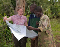
 GIS is an essential tool in analyzing and determining spatial relationships and functions in the Horticulture Collaborative Project. The shapefiles purchased in January from the Malawian survey office were reprojected to UTM coordinates and analyzed to determine what the contents of each shapefile.
· Cont.shp – Height contour lines in feet above sea level. Digitized from the topoquad basemaps.
· Dambo.shp – polygons representing marshes and dambos.
· Jenda_Euthini road.shp – single line representing road S112
· Rd.shp – detailed roads layer, contains several classes of road (primary, secondary, tertiary)
· Riv.shp – rivers and streams
· Ta.shp – polygons representing the boundaries of the Traditional Authorities
· Trigs.shp – appears to be benchmark locations measures in meters above sea level
· Vil.shp – village locations. Do not seem to coincide with the location of villages on topoquad map.
· Fore.shp –boundaries for the Perekezi and South Viphya forests.


No comments:
Post a Comment
Note: Only a member of this blog may post a comment.