

 The distinct wet/dry seasons of Mzimba require complete consideration of irrigation options for a successful horticulture projects. Not only do sources of irrigation water need to be considered, but also the energy needed to move the water from its source. Currently human energy using treadle pumps have been the main energy source for moving water. The Team is interested in considering other forms of energy that would be more efficient. Wind energy is one of these forms.
 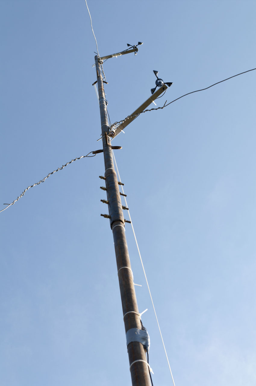 To begin gathering information on wind speeds, two anemometer towers were installed to log wind speed and direction data. The locations for the towers were: 1) along a floodplain near the Laswozi River and 2) next to the World Relief District office near the Embangweni town center. These locations were considered exemplary of the larger area in terms of their elevation, aspect and proximity to a perennial stream as an irrigation water source.
 The anemometers were manufactured by Onset®. Two anemometers were connected to each of the two towers and placed at a 6.5 m and 10 m height above the ground surface. The anemometers were connected a HOBO® data logging device at 1.5 m above the ground surface.
 The anemometers were programmed using HOBOware® Pro 2.3.0 software to collect and average data at 1 second and 30 second intervals respectively. Hudson and Dameseko were trained on how to download datafiles from the HOBO® logger and restart the anemometers.

Hudson Kaunda, Field Agriculture Coordinator provided expert knowledge on soil texture classes in Mzukuzuku. The soil texture regions designated on the topoquad will be transferred into a shapefile by the BSU team.
No comments:
Post a Comment
Note: Only a member of this blog may post a comment.